

Backcountry Avalanche Forecast Snoqualmie Pass
Northwest Avalanche Center
www.nwac.us
- Issued
- Thursday, October 15, 2026 - 6:00PM
- Expires
- Friday, October 16, 2026 - 6:00PM
- Author
- Rachel Fryan
The Bottom Line
Warm, wet, and windy conditions should create very dangerous avalanche conditions Wednesday. Avoid traveling in areas where avalanches can start, run, and stop. Natural avalanches will be most likely during periods of intense precipitation, blowing snow, and rapidly warming temperatures.
Avalanche Danger
Friday, October 16, 2026
6500-5500ft4 - High
5500-4000ft4 - High
4000-2500ft3 - Considerable
Saturday, October 17, 2026
- Upper Elevations
6500-5500ft4 - High - Middle Elevations
5500-4000ft3 - Considerable - Lower Elevations
4000-2500ft2 - Moderate
 1 - Low | 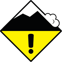 2 - Moderate | 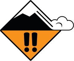 3 - Considerable | 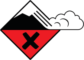 4 - High | 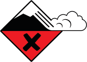 5 - Extreme | |
|---|---|---|---|---|---|
| Travel Advice | Generally safe avalanche conditions. Watch for unstable snow on isolated terrain features. | Heightened avalanche conditions on specific terrain features. Evaluate snow and terrain carefully; identify features of concern. | Dangerous avalanche conditions. Careful snowpack evaluation, cautious route-finding and conservative decision-making essential. | Very dangerous avalanche conditions. Travel in avalanche terrain not recommended. | Extraordinarily dangerous avalanche conditions. Avoid all avalanche terrain. |
| Likelihood of Avalanches | Natural and human-triggered avalanches unlikely. | Natural avalanches unlikely; human-triggered avalanches possible. | Natural avalanches possible; human-triggered avalanches likely. | Natural avalanches likely; human-triggered avalanches very likely. | Natural and human-triggered avalanches certain. |
| Avalanche Size and Distribution | Small avalanches in isolated areas or extreme terrain. | Small avalanches in specific areas; or large avalanches in isolated areas. | Small avalanches in many areas; or large avalanches in specific areas; or very large avalanches in isolated areas. | Large avalanches in many areas; or very large avalanches in specific areas. | Very large avalanches in many areas. |
Avalanche Problems (2)
Problem #1: Storm Slab
Problem Type
Aspect/Elevation
Likelihood
Size
Anticipate large natural and human triggered avalanches at mid and upper elevations. If you travel out of the deep dark forest, stay away from areas where avalanches start, run, and stop. All the pieces are in place for a natural storm slab cycle; weak snow surfaces, heavy snowfall, warming temperatures, and strong winds. The question is more about when will the avalanches occur rather than if. Look for avalanche activity to peak during periods of snow changing to rain, heavy precipitation, and blowing snow.
Problem #2: Wet Loose
Problem Type
Aspect/Elevation
Likelihood
Size
As temperatures warm snow will transition to rain. When this happens, you will probably see loose wet avalanches. Steer away from steep slopes and be aware of terrain above you. Wet avalanches can be tricky. You could see wet slab avalanches in areas where enough new snow accumulates over the weak snow surface prior to changing to rain. As snow levels continue to rise to higher elevations wet avalanches could become larger and travel further.
Two other avalanche concerns should be on your mind. Glide avalanches could occur as more rain lubricates the ground below the snowpack. Additionally, cornices could fail naturally. Be leery of traveling on or below either of these timebombs.
Forecast Discussion
Heavy snow Tuesday night turns to rain and high-elevation snow Wednesday as snow levels climb. New snow is sitting on a slick crust from late January, and strong southwest winds are building deeper slabs on lee slopes near and above treeline. Expect storm slabs to be easy to trigger and capable of running full track wherever more than a foot of new snow has accumulated.
As rain soaks into the new snow below about 4,500 ft, wet loose avalanches become the concern. Avoid travel on or beneath open slopes steeper than 35 degrees, and give terrain traps and gullies a wide berth. This is a day to keep it simple: stick to low-angle, well-supported terrain.
Mountain Weather · Afternoon Forecast
- Issued
- Thursday, October 15, 2026 - 2:30PM
- Author
- Rachel Fryan
Tonight
Thu Oct 15Mostly cloudy with a chance of showers before midnight. Light to occasionally moderate ridgeline and Pass level W winds.
Tomorrow
Fri Oct 16Cloudy, with light to moderate snow developing by mid-day and increasing in the afternoon. Light to moderate S ridgeline winds and E Pass level winds.
| Thu Oct 15Night | Fri Oct 16Day | Fri Oct 16Night | Sat Oct 17Day | |
|---|---|---|---|---|
| Snow (in) | T–1" | 1–3" | 6–10" | 2–4" |
| Snow level (ft) | Eve 3,500' snow level Night 3,500' snow level | AM 2,500' snow level PM 3,000' snow level | Eve 2,500' snow level Night 2,500' snow level | AM 6,000' snow level PM 6,000' snow level |
| 5000' Temperatures (°F) | 25 / 22 | 27 / 24 | No forecast | |
| Ridge wind (mph) | Eve W5–10Light Night W5–10Light | AM SSE5–10Light PM SSE15–25Moderate | No forecast | |
Night
- Snow (in)
- T–1"
- 5000' Temperatures (°F)
- 25 / 22
| Snow level (ft) | Ridge wind (mph) | |
|---|---|---|
| Evening | 3,500' snow level | W5–10Light |
| Night | 3,500' snow level | W5–10Light |
Day
- Snow (in)
- 1–3"
- 5000' Temperatures (°F)
- 27 / 24
| Snow level (ft) | Ridge wind (mph) | |
|---|---|---|
| Morning | 2,500' snow level | SSE5–10Light |
| Afternoon | 3,000' snow level | SSE15–25Moderate |
Night
- Snow (in)
- 6–10"
- 5000' Temperatures (°F)
- No forecast
| Snow level (ft) | ||
|---|---|---|
| Evening | 2,500' snow level | |
| Night | 2,500' snow level |
Day
- Snow (in)
- 2–4"
- 5000' Temperatures (°F)
- No forecast
| Snow level (ft) | ||
|---|---|---|
| Morning | 6,000' snow level | |
| Afternoon | 6,000' snow level |
SnowT–2", 1–7", 5–16", 12"+Snow level; none, freezing level<2,000', 2,000', 3,000', 4,000', 5,000', 6,000', 7,000', 8,000', 9,000', 10,000'+
This information is provided by the U.S.D.A. Forest Service and describes general backcountry avalanche hazard and conditions.
It does not apply to ski areas and highways where avalanche mitigation is conducted.