

Backcountry Avalanche Forecast Snoqualmie Pass
Northwest Avalanche Center
www.nwac.us
- Issued
- Saturday, October 10, 2026 - 6:00PM
- Expires
- Sunday, October 11, 2026 - 6:00PM
- Author
- Rachel Fryan
The Bottom Line
The threat of human triggered avalanches large enough to bury and kill you will persist on Saturday. We are on the tail end of a major storm and avalanche cycle, careful snowpack evaluation and conservative decision-making are essential.
Avalanche Danger
Sunday, October 11, 2026
6500-5500ft3 - Considerable
5500-4000ft3 - Considerable
4000-2500ft2 - Moderate
Monday, October 12, 2026
- Upper Elevations
6500-5500ft3 - Considerable - Middle Elevations
5500-4000ft3 - Considerable - Lower Elevations
4000-2500ft2 - Moderate
 1 - Low | 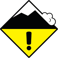 2 - Moderate | 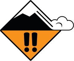 3 - Considerable | 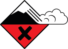 4 - High | 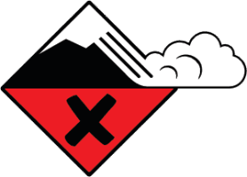 5 - Extreme | |
|---|---|---|---|---|---|
| Travel Advice | Generally safe avalanche conditions. Watch for unstable snow on isolated terrain features. | Heightened avalanche conditions on specific terrain features. Evaluate snow and terrain carefully; identify features of concern. | Dangerous avalanche conditions. Careful snowpack evaluation, cautious route-finding and conservative decision-making essential. | Very dangerous avalanche conditions. Travel in avalanche terrain not recommended. | Extraordinarily dangerous avalanche conditions. Avoid all avalanche terrain. |
| Likelihood of Avalanches | Natural and human-triggered avalanches unlikely. | Natural avalanches unlikely; human-triggered avalanches possible. | Natural avalanches possible; human-triggered avalanches likely. | Natural avalanches likely; human-triggered avalanches very likely. | Natural and human-triggered avalanches certain. |
| Avalanche Size and Distribution | Small avalanches in isolated areas or extreme terrain. | Small avalanches in specific areas; or large avalanches in isolated areas. | Small avalanches in many areas; or large avalanches in specific areas; or very large avalanches in isolated areas. | Large avalanches in many areas; or very large avalanches in specific areas. | Very large avalanches in many areas. |
Avalanche Problems (1)
Problem #1: Storm Slab
Problem Type
Aspect/Elevation
Likelihood
Size
Human triggered avalanches are likely and natural avalanches will be possible on Saturday at all elevations. Slabs will grow dramatically in size as you ascend in elevation, reaching large to very large in some areas. Snoqualmie Pass is hovering around 10 inches of continuous water since Tuesday afternoon, coming in the form of both rain and snow, depending on elevation. Observations have been limited at upper elevations and we have a great deal of uncertainty, but it would not be surprising to see up to 5 feet of snow sitting on top of the 2/1 crust and that a significant natural avalanche cycle has occurred. With strong winds, slabs could be even larger and stiffer on leeward slopes. We are concerned with new slabs formed on Friday night having a poor bond to the old snow surface (2/7 interface) and failing. More concerning will be slabs breaking deeper to the 2/4 interface or 2/1 crust. Avalanches up to size D3 produced by Alpental Patrol as recently as Friday have mostly run on the crust, while some slides failed on weak snow (2/4 interface) before entraining down to the crust.
Lower elevations have seen a mix of rain and snow throughout this event, with a notable wet avalanche cycle. At these lower elevations, avalanche problems should be isolated to new snow sitting on the 2/7 interface, but the threat of a lingering wet related avalanche cannot be ruled out. At all elevations, take time and investigate these bonds and how much snow makes up the potential slab. If you find a poor bond, see shooting cracks in the snow, or experience whumpfing, avoid all avalanche terrain where avalanches can start, run, or stop.
Forecast Discussion
Showers taper and temperatures cool behind the atmospheric river, allowing the wet snowpack to begin refreezing. Recent storm slabs are gaining strength but can still be triggered on steep, wind-loaded slopes near and above treeline, especially where new snow sits on the early-February crust.
Look for shooting cracks and recent avalanches as signs that slabs remain sensitive. Choose lower-angle terrain, avoid convex rollovers and cornices, and expect conditions to keep improving as the snowpack stabilizes.
This information is provided by the U.S.D.A. Forest Service and describes general backcountry avalanche hazard and conditions.
It does not apply to ski areas and highways where avalanche mitigation is conducted.